Project stakeholders
The project is driven by the Port of Klaipėda, in Lithuania, with the participation of MC Baltics, partner responsible for developing a hydrometeorological prediction algorithm based on machine learning using the data collected by the system.
Project description
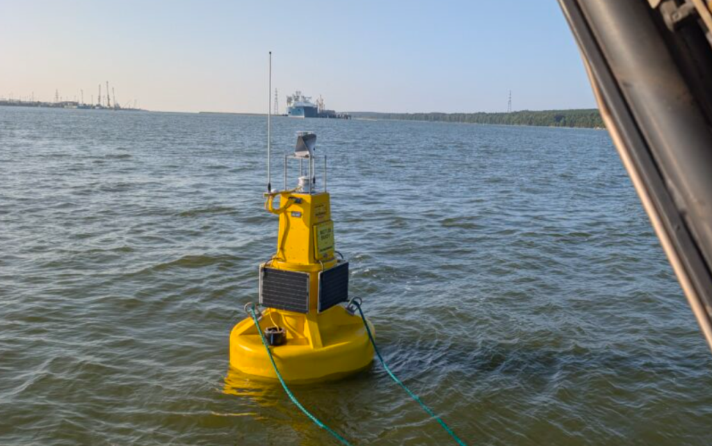
This innovative project has developed and deployed a smart buoy equipped with advanced sensors to improve navigation safety and support the operational management of the Port of Klaipėda. The initiative is part of the European MOVEO project, funded under the European Union’s Horizon programme, aimed at developing and testing innovative solutions to advance towards safer, more efficient and sustainable port operations.
The buoy is located in the Baltic Sea, four nautical miles from the port entrance, and acts as a real-time monitoring system for maritime conditions. The infrastructure collects and transmits data on different environmental variables, such as wave height, direction and period, current speed and direction, water and air temperature, atmospheric pressure and possible GPS signal interference. This information is processed and stored at the Port Authority’s data centre.
The main innovation of the project lies in the combination of real-time environmental monitoring, data connectivity and machine learning applied to port navigation. Data collected directly from the marine environment enables the generation of operational information to support decision-making and improve the planning of port movements.
In a subsequent phase, MC Baltics will use this data together with historical information to develop a hydrometeorological prediction algorithm based on machine learning. This system aims to provide more accurate predictions of maritime conditions in the port and its approaches, facilitating adjustments to logistics plans and cargo and transport flows.
In addition to its monitoring and prediction functions, the buoy incorporates a specific application to enhance navigation safety in situations involving GPS signal interference. In these cases, the buoy acts as a reliable reference point for vessels approaching the Port of Klaipėda.
This system allows vessels to navigate towards the maritime area where they are met by the Port Authority pilots. The pilots then use specialised equipment designed to operate despite GPS signal interference to safely guide vessels into and through the port infrastructure.
The project demonstrates how real-time environmental data collected from the marine environment can be transformed into digital navigation support tools, contributing to safer, more coordinated and more efficient port operations.
Project objectives
The main objective is to develop a smart buoy equipped with advanced sensors that acts as a real-time maritime condition monitoring system to improve navigation safety and support the operational management of ports.
This innovative solution is based on data that can improve navigation safety, strengthen resilience against GPS signal interference and support more efficient management of port flows.
The project also aims to generate predictive capabilities through the use of machine learning to anticipate maritime conditions, facilitate operational planning and advance towards safer, more efficient and sustainable port operations.
Publication date
22 September 2026